maps
Map and geospatial projects: interactive weather data visualization with OpenLayers, built for professional and open-source applications.
maps projects
3 Apr 2026
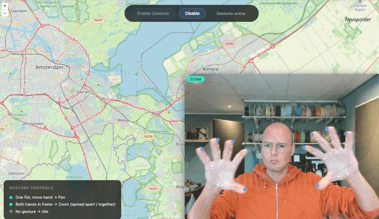
Open Source Hand Gesture Controls for Maps in the Browser
Open source library for controlling OpenLayers, Google Maps, and Leaflet with hand gestures. Pan, zoom, and rotate maps without touching the screen.
1 Jan 2020
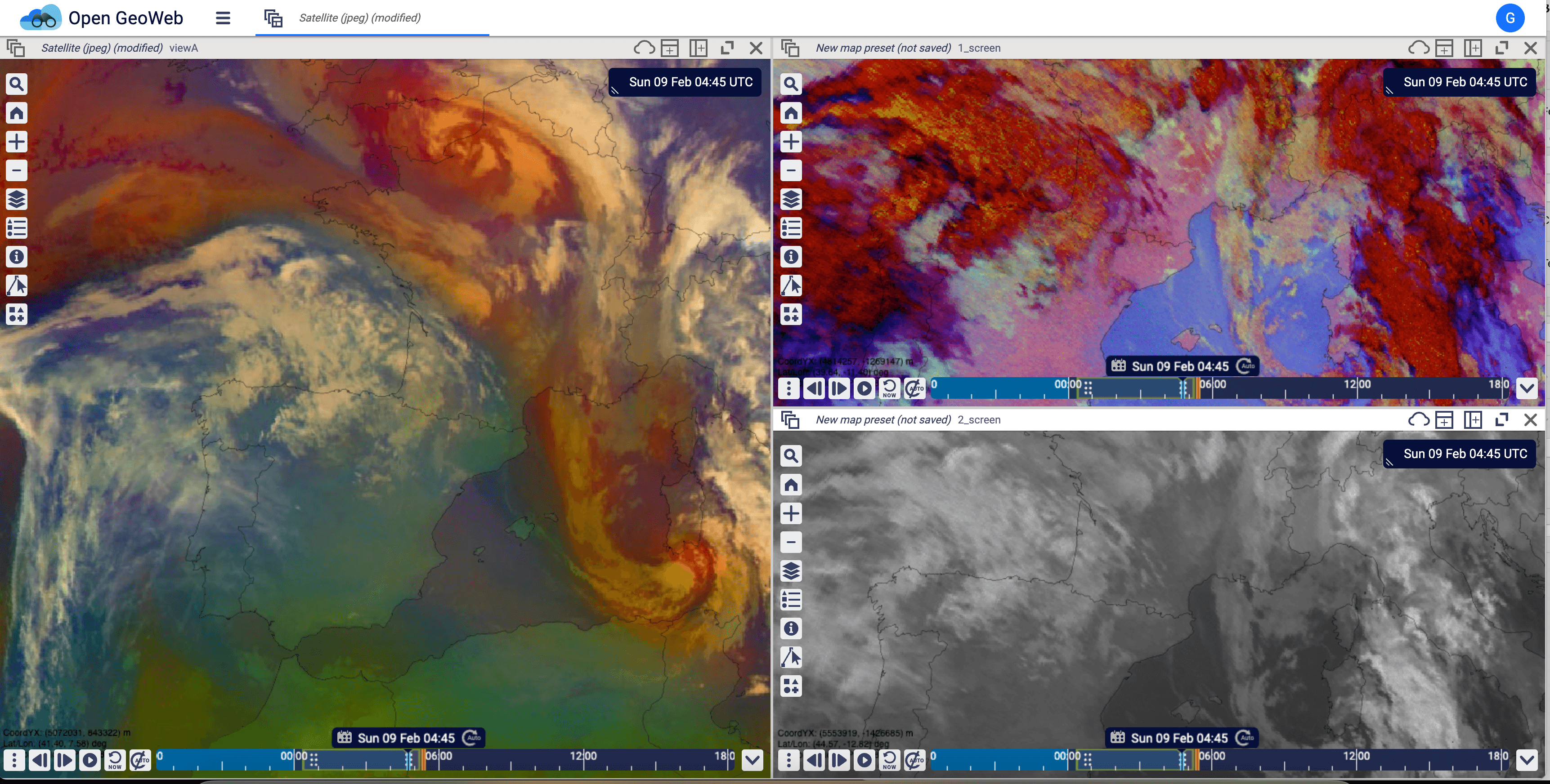
Open GeoWeb: Open Source Weather and Geospatial Platform
Open source web platform for real-time weather monitoring and geospatial data visualization. Built for meteorologists to create forecasts, alerts, and warnings.
maps articles
12 Apr 2026
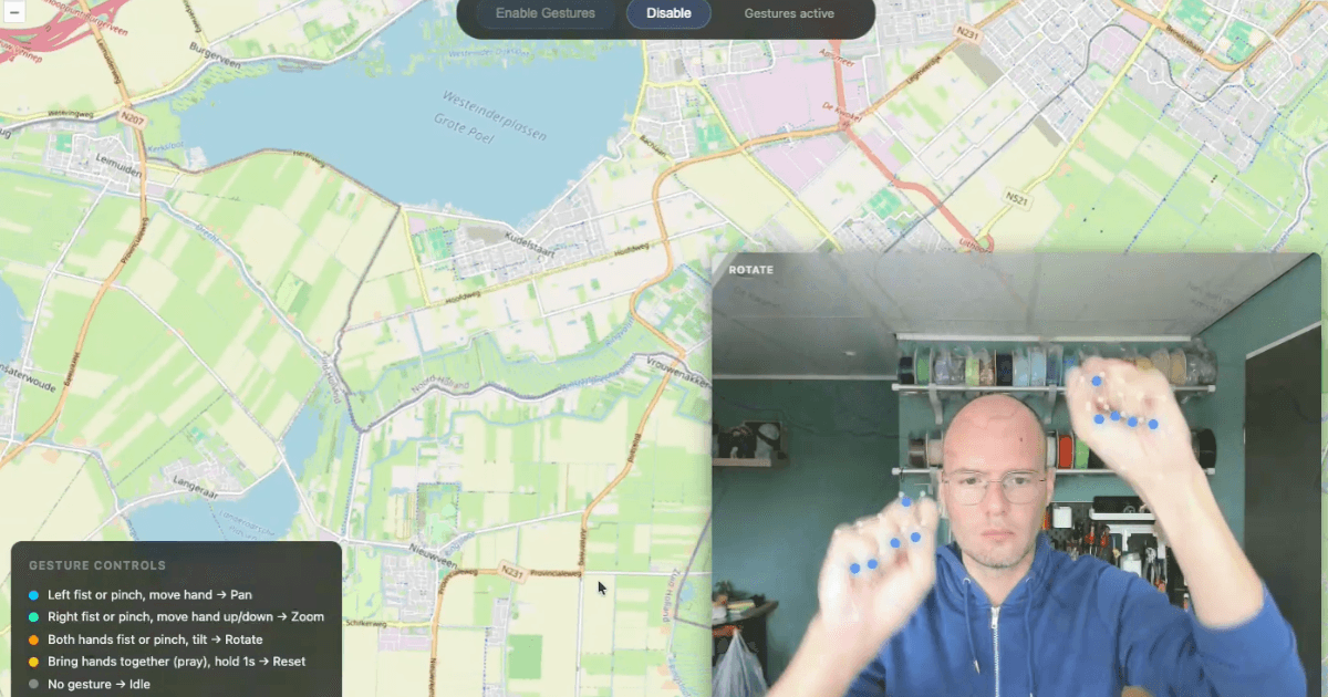
Gesture Controls for OpenLayers, Google Maps & Leaflet
Add open source hand gesture controls to OpenLayers, Google Maps and Leaflet with MediaPipe hand tracking. Pan, zoom and rotate maps by webcam.